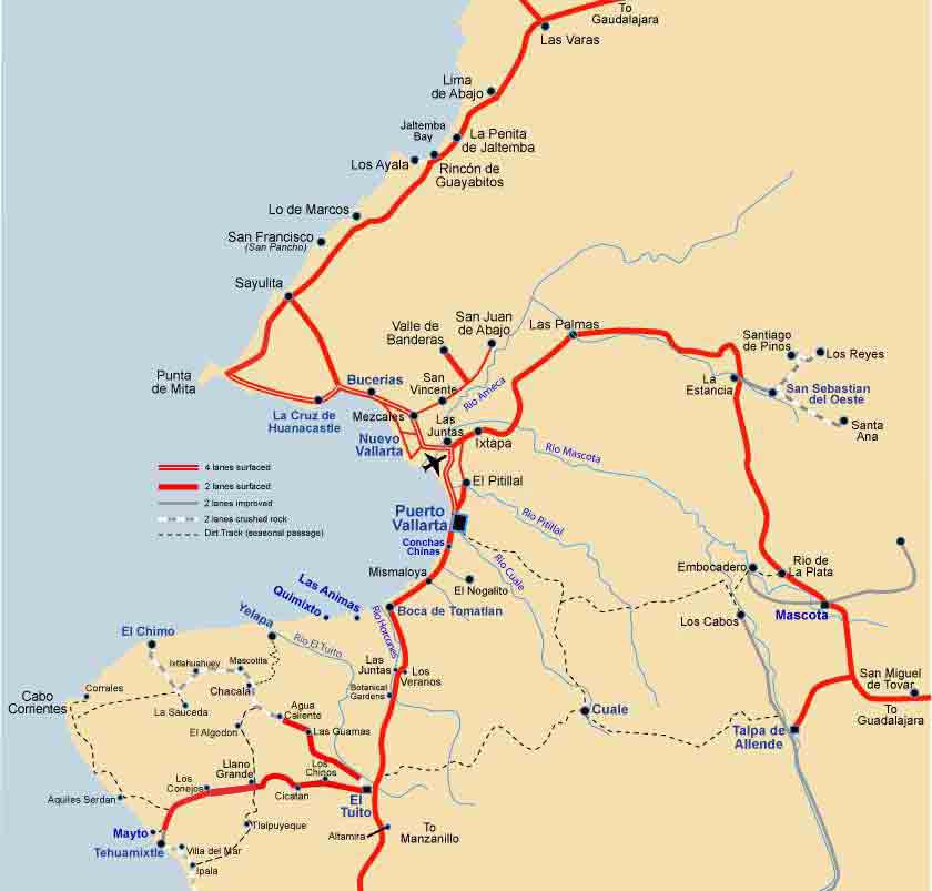

The bridge over the Rio Ameca, forms the boundary between the State of Jalisco, where Puerto Vallarta is, and the State of Nayarit, where you’ll find Nuevo Vallarta and other Beach Towns inside and outside the bay.
The Vallarta Marina starts at the Marine Terminal, where the cruise ships dock, adjacent to Sam’s Club, Walmart and the Galerías Mall.
On the northern part of this basin is the Marina where you’ll find private yachts and condos, between the two is Los Peines, where most fishing charter boats berth. On the ocean side of this area are more hotels. Just to the north is the Marina Golf Course and the airport, inland from the airport is the central bus station.
Downtown, the Real “Old Town” – Go To Map
The oldest part of Puerto Vallarta, is from Parque Hidalgo to the Rio Cuale, when once upon a time there were just planks on rocks to cross over the river. About 1933 a cable bridge was constructed. It wasn’t until the fifties that a stone bridge was built at Miramar (1954), which got to be called the Old Bridge, when the ‘New’ one was built years later down river at Morelos.
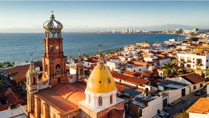
Here you’ll find the Presidencia (Town Hall) and the main church, Nuestra Señora de Guadalupe (Our Lady of Guadalupe). Also the main Plaza, where many events take place.
Across from the Plaza, by the shore, is the Los Arcos Amphitheater, Theater de Aquiles Serdan, where many music, dance and theatrical performances occur in the evenings.
The Malecón (an oceanfront walkway) is the place that locals meet each other, mostly on Saturday and especially on Sunday evenings. Also on Sunday, at 6pm there’s Municipal Band concert and 7pm a public dance in the plaza, this is ballroom style.
Walking to the north end, at the Rosita Hotel (one of the first here), you’ll pass many sculptures of many different styles, sometimes art exhibits and, of course, the sand sculptures.
On the other side of the road (Paseo Diaz Ordaz) are many night clubs, restaurants and stores that cater to the tourist. Nothing cheap here, this is the most expensive real estate in town.
From Los Arcos Amphitheater you can now walk south on the Malecón all the way to Los Muertos beach.
Behind the church there’s a steep hill, this is Gringo Gulch and runs between the river to behind the church, it was popularized right after WWII by some veterans from that war, looking for some peace and quiet.
Later the ‘Rich & Famous’ started to build there, after Richard Burton & Elizabeth Taylor took up residence on Zaragoza.
At the point where the Malecón cuts inland, by the ‘Boy of a Seahorse’ statue, was the location of the Oceana Hotel, with it’s bar on the corner, habitually inhabited by Burton and his drinking buddy Peter O’Toole.
Next to it is a structure usually called a lighthouse, a column painted with white and black horizontal stripes and a light on the top. This is actually a ‘Range Light’, which in conjunction with the other one up the hill on Matamoros, would guide ships into the bay, to be unloaded, by pangas. This was before there was a decent road into town or a marina.
The South Side of Town, Old Town or Romantic Zone – Go To Map
Incorrectly called ‘Old Town’ (downtown is much older, the 1st bridge over Rio Cuale wasn’t built till 1954) this part of Vallarta has less of the commercialism which has affected downtown, it also has less timeshare booths ?. Called by a variation of names, “Romantic Zone” was the brainchild of some local politicians, who thought “Playa Los Muertos” was not a good name, it means “Beach of The Dead”, although the average tourist wouldn’t understand that ? We prefer the “South Side”, being the south side of the Rio Cuale which divides the town.
Los Muertos Beach is the focal point in the South Side for tourists. A busy beach with a mix of tourists and locals, many beachside restaurants and bars, also a pier for fishing boats and water taxis to the south side of the bay.
The farther inland from the beaches you explore, you’ll find of the beautiful, traditional Mexico neighbourhoods, it is a more residential area, with some hidden gems of restaurants for those in the know. see the Insider’s picks. There will be fewer tourists and you’ll experience the atmosphere of what Puerto Vallarta was like before it became the tourist destination it is today.
We have two bridges across the Rio Cuale now, connecting the South Side to Downtown, one northbound and one southbound. There’s also a pedestrian bridge by the beach which connects from the downtown Malecón (seaside promenade) all the way to our ‘Disco’ pier on Los Muertos Beach.
North of Downtown and the Hotel Zone – Go To Map
North of the Rosita Hotel is mostly a local business area, with a few hotels, and our Sports Stadium, which has a State of the Art running track, as well as, soccer, baseball fields, exercise equipment and even a skateboard area.
Apart from the supermarkets Leys and Mega Store, there’s an interesting local Municipal Market in Colonia 5 de Diciembre, next to the cemetery.
Most of the big hotels, between the Sports Stadium and the Marina are in what we call the Hotel Zone, this area is full of hotels next to each other on the beach, inland is mostly a business district apart from a few new nightclubs and restaurants.
Pitillal – Go To Map
Once an outlying village, Pitillal is now in the Municipality of Puerto Vallarta. Very non-touristy with some good local food and shopping.
Marina & Airport – Go To Map
The Marina starts at the Marine Terminal, where the cruise ships dock, adjacent to Sam’s Club, Walmart and the Liverpool Mall.
On the northern part of this basin is the Recreational Marina with private yachts and condos, between the two is Los Peines, where most fishing charter boats berth. On the ocean side of this area are more hotels. To the north past the Marina Golf Course is the airport, inland to the central bus station and eventually the bridge over the Rio Ameca, which forms the boundary between the State of Jalisco, where Puerto Vallarta is, and the State of Nayarit, where you’ll find Nuevo Vallarta.
South Around The Bay
On the south side of the bay the Sierra Tuito mountains come right down to the shore, covered with thick foliage and very steep. This is the mountain range that protects Puerto Vallarta from hurricanes, if they come up the coast from the south.
There are a few beaches with small villages, once engaged in fishing and now handling tourists, a couple have waterfalls in the back of them as an added attraction, Las Animas, Quimixto, Caletas, Majahuitas and Yelapa. Some small beaches also exist without villages, but all have to be reached by boat, or are more easily reached by boat, as the main highway going south, turns inland at Boca de Tomatlan.
There is a “road” to Yelapa, best driven in the dry season and very carefully with a four wheel vehicle, also one that goes to Chimo. But it’s quicker and easier by boat. One nice little beach at Los Colomitos can be hiked to from Boca de Tomatlán. See Yelapa and Hidden Beaches.
