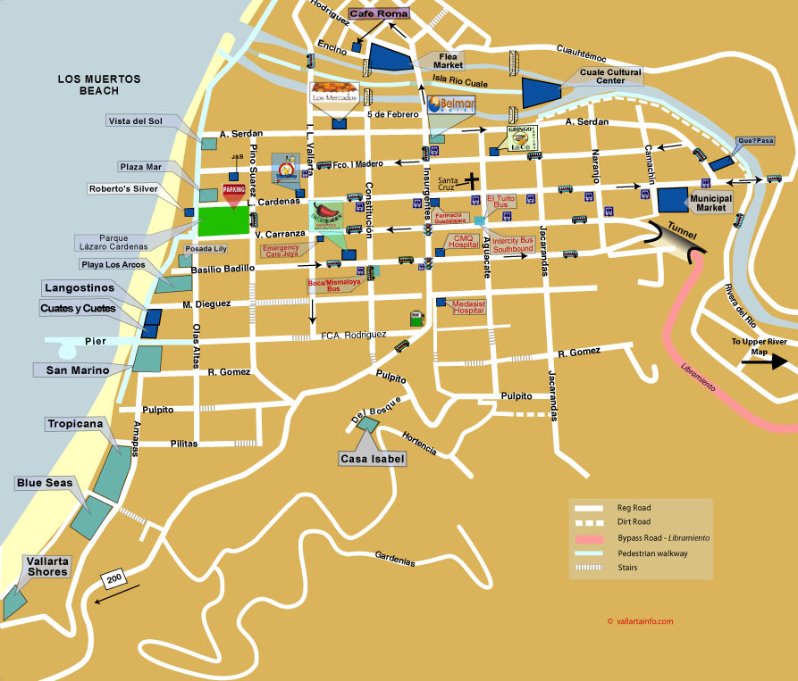
The Old Town map of Puerto Vallarta. Incorrectly called Old Town (downtown is much older, the 1st bridge over Rio Cuale wasn’t built till 1954) this part of Vallarta has now developed with many condo buildings, concentrated towards Los Muertos Beach.
Called by a variation of names, “Romantic Zone” But Old Town has been adopted over the “South Side”, being the south side of the Rio Cuale which divides the town.
Los Muertos Beach is the focal point in the Old Town for tourists. A busy beach with a mix of tourists and locals, many beach side restaurants and bars, also a pier for fishing boats and water taxis to the south side of the bay.
The farther inland from the beaches you explore, the more you’ll find of the beautiful, traditional Mexico neighborhoods, it is a more residential area, with some hidden gems of restaurants for those in the know. see the Insider’s picks. There will be fewer tourists and you’ll experience the atmosphere of what Puerto Vallarta was like before it became the tourist destination it is today. See this Map for even further from the beach.
We have two bridges across the Rio Cuale now, connecting the South Side to Downtown, one northbound and one southbound. There’s also a pedestrian bridge by the beach which connects from the downtown Malecón (seaside promenade) all the way to our ‘Disco’ pier on Los Muertos Beach.
